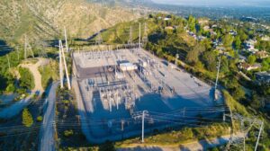
Make no mistake—the cost of grid hardening, which involves investing in technologies to make the electric grid more resilient, is rising in the U.S. and worldwide. For example, according to Wood Mackenzie, 25 investor-owned utilities in the U.S. have filed for $36.4 billion of investment into grid modernization, with 80% focusing on grid hardening and related infrastructure. In addition, the Department of Energy is dedicating $5 billion towards making transmission and distribution systems more resilient—and reliable.
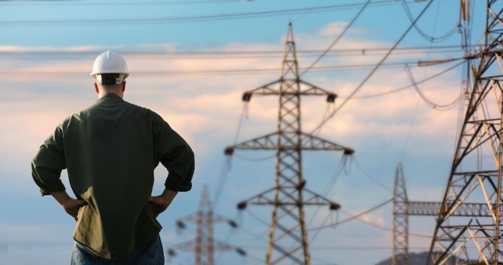
But upgrading infrastructure isn’t easy. Beginning with a grid built more than half a century ago. Today, utilities face extreme weather, integration of renewables, cybersecurity and other challenges that increase cost, complexity and risk.
That’s why more utilities are turning to modern geospatial solutions, specifically the Esri ArcGIS Utility Network, as an integration platform to support grid resiliency and reliability. By integrating GIS with other systems and moving to a model-centric network that better represents real-world conditions, utilities enhance their ability to predict, prevent and respond to disruptions. This ensures a more stable and efficient energy supply transitioning from departmental applications to a connected enterprise to build stronger, more resilient grids.
 Grid Resiliency and Reliability for Utilities Today
 Grid Resiliency and Reliability for Utilities Today
Grid resiliency and reliability combine as interconnected concepts crucial for maintaining a stable and efficient power supply. Grid reliability refers to the ability of the power system to consistently deliver electricity without interruptions, to ensure power is available when needed. This requires having sufficient generation resources and robust infrastructure to minimize outages under normal operating conditions. Grid resiliency involves the power grid’s ability to withstand, adapt to and rapidly recover from disruptive events such as extreme weather, equipment failures or cyberattacks.
For utilities looking to modernize operations and digitally transform workflows, a focus on grid reliability and resiliency matters because:
- Grid reliability prevents outages and maintains a consistent power supply under normal conditions. It ensures that the grid functions as expected, providing electricity without interruptions.
- Grid modernizing improves its capacity to withstand and quickly recover from major disruptions such as natural disasters, cyberattacks and extreme weather conditions that continue to occur with climate change. A resilient grid can efficiently isolate damaged areas, reroute power and restore service.
Both complement each other; a reliable grid is better positioned to be resilient, as it has the foundational infrastructure to support rapid recovery from disruptions. Conversely, enhancing resilience can improve overall reliability by ensuring the grid maintains functionality during extreme events. Together, they provide a consistent, reliable and secure power supply.
Modernizing the Grid Causes Complexity
Achieving grid resiliency in the modern era is more challenging for utilities than ever, particularly for managing and maximizing digital devices, technologies, software, applications and data.
Let’s begin with integrating legacy systems with modern technologies. Many utilities operate with outdated I.T. infrastructure and data management systems that struggle to keep pace with real-time monitoring and predictive analytics demands. The sheer volume of data generated by modern grids can overwhelm traditional data management systems, making it difficult to extract actionable insights.
Another significant challenge includes the lack of standardized data formats and interoperability between different systems. This can lead to siloed information, making it hard for utilities to view their grid operations comprehensively. Moreover, the increasing threat of cyberattacks to utility networks poses a significant risk to grid security, requiring utilities to invest heavily in cybersecurity measures.
Lastly, the cost and complexity of implementing new technologies can be daunting. Utilities must balance the need for modernization with budget constraints and to justify the return on investment. This requires ensuring that modernization or digital transformation initiatives deliver on promised business goals and objectives on time and within budget.
Utility challenges to grid resiliency and reliability:
- Integration of Legacy Systems: Combining old infrastructure with new technologies.
- Data Management: Handling the vast amounts of data generated by modern grids.
- Interoperability: Ensuring seamless communication between different systems.
- Cybersecurity: Protecting against increasingly sophisticated cyber threats.
- Cost and ROI: Balancing costs and budget constraints with business goals.
Leveraging the ArcGIS Utility Network for a Resilient, Reliable Grid
Modern geospatial solutions, such as the Esri ArcGIS Utility Network, provide utilities with advanced toolsets powered by cutting-edge technology to address challenges in grid resiliency and reliability. By leveraging model-based network analysis, spatial analysis, maps, and location intelligence, utilities can manage utility infrastructure with highly detailed grid data gaining a comprehensive understanding of their grid operations. This includes visualizing networks, monitoring real-time conditions, predictive maintenance needs and predicting potential disruptions.
Spatial analysis and location intelligence allow utilities to visualize geometrically accurate digital representations of the entire network. This includes sophisticated flow analysis to identify potential risks and make informed decisions. Using geospatially accurate mapped data, business critical insights are gained for maintenance and upgrades, building out and modernizing the grid, as well as proactively strengthening or hardening weak points.
GIS tools and modeling capabilities enable real-time monitoring and control of assets, enabling utilities to respond to outages quickly and prevent future disruptions. For instance, GIS-based outage management systems integrate data from various sources to pinpoint outage locations, assess impact and identify the appropriate crews to dispatch, thereby minimizing downtime, reducing time to restoration and improving customer satisfaction.
In addition, modern geospatial software facilitates predictive maintenance by monitoring and analyzing location-based sensor data and environmental factors to anticipate equipment failures. Utilities can use an advanced map application to schedule proactive maintenance and reduce outages.
One of the most powerful capabilities of modern geospatial software is its ability to provide an integration platform for connecting with other systems, such as advanced distribution management systems (ADMS) and operational technology (OT), which provides even greater grid resilience.
Using location to unify data from different sources, utilities gain a locationally accurate, holistic operational picture supporting strategic planning and real-time decision-making. Moreover, accurate geospatial data is crucial for precise network representation and reliable decision-making, ensuring utilities can optimize power distribution and respond effectively to emergencies.
ArcGIS Utility Network enables utilities to store, manage, and analyze their asset information in a detailed, structured and standardized manner. It provides a robust framework for managing complex network data in a standardized manner.
For example, it supports interoperability and open standards such as the common information model (CIM), which is widely adopted in the utility industry. This allows utilities to integrate their data seamlessly with other systems and workflows, ensuring compatibility with industry-standard systems and compliance protocols. It also enforces data quality and improved data integrity through network rules, attribute rules and validation processes.
The ArcGIS Utility Network provides powerful analysis tools that allow utilities to trace network connectivity and identify areas of inefficiency. Real-time data integration supports predictive maintenance strategies, helping utilities prolong asset lifespan and reduce lifecycle costs.
Modern geospatial benefits include:
- Enhanced asset management: Utilities can track and manage assets more effectively, reducing maintenance costs and improving asset lifespan.
- Improved outage response: Real-time monitoring and predictive analytics enable faster identification and resolution of outages, enhancing customer satisfaction.
- Optimized grid performance: Advanced analytics help utilities optimize energy distribution, reducing waste and improving efficiency.
- Enhanced cybersecurity: ArcGIS features like authentication, authorization, encryption, and auditing ensure utilities can securely manage their data and systems.
Real-World Applications That Enhance the Grid
Modern geospatial solutions like the ArcGIS Utility Network have numerous real-world applications that can significantly enhance grid resiliency and reliability. Utilities can benefit from integrated applications, location analytics and visualized data across the enterprise in various scenarios, from storm response planning to infrastructure planning. These applications not only improve operational efficiency but also enhance customer service.
Some of the key use cases include:
- Storm response planning: Utilities can use spatial analysis to predict storm impacts and plan response efforts more effectively.
- Inspection schedules: More efficient and risk prioritized inspection operations through accurate and reliable spatial data analysis.
- Outage management: Real-time mapping helps utilities quickly identify and respond to outages.
- Customer service enhancement: Spatial data can improve communication with customers during outages.
- Grid modernization: Utilities can use geospatial tools to plan and execute grid modernization projects more efficiently.
How TRC Can Help Utilities Implement the ArcGIS Utility Network
Utilities often face significant challenges when implementing the ArcGIS Utility Network, including data migration, system integration, and training personnel. TRC helps utilities overcome these hurdles by providing expert guidance and support throughout planning, system design and implementation. TRC’s experienced team works closely with utilities to tailor solutions that meet their needs, from assessing current systems to ensuring seamless integration with existing infrastructure.
TRC also assists in developing comprehensive training programs to ensure that utility staff can effectively deploy the ArcGIS Utility Network, maximizing its potential to enhance grid resiliency and reliability. By partnering with TRC, utilities can provide a successful transition to modern geospatial solutions, positioning themselves for long-term success in an increasingly complex energy landscape.